GPS Fields Area Measure Tool
Fluent Farming
ADVERTISEMENT
About this app
- Category Tools
- Installs 959k+
- Age 10
- Updated Aug 6, 2024
- OS Android
ADVERTISEMENT
Editor reviews
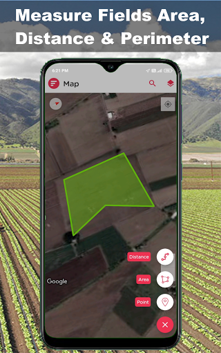
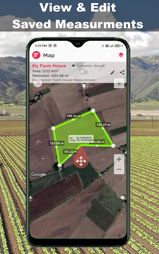
GPS Fields Area Measure Tool is an accurate and easy-to-use app designed to help users measure distances, areas, and perimeters on a map using GPS technology. It’s ideal for a variety of purposes, including land surveying, farming, landscaping, property management, and construction. The app allows you to pinpoint areas on a map, draw boundaries, and calculate the area or distance in real-time, providing precise results.
With features such as multiple measurement units, manual or GPS-based area marking, and the ability to save and share measurements, GPS Fields Area Measure Tool is a versatile tool for professionals and casual users alike. Whether you’re measuring fields, properties, or distances, the app simplifies the process with its user-friendly interface and reliable GPS accuracy.
ADVERTISEMENT
Screenshots
Recommanded games

Citrix Secure Access

Trailforks: Offline Bike Maps

Diamond Gold Watch Face

Cantook by Aldiko

Wildflower Id USA Photo Recog.

Reina Valera 1960 Santa Biblia

NYC Fire Wire

Hearty App: Everyday Bonding

krsuor

TonalEnergy Tuner & Metronome

VMware Explore

Noise Machine - Green, White

Performance Stretching - Foam Roller, Static, and Dynamic Stretches

Boosted Ad Maker by Lightricks

LiveCollage Classic - Instant Collage Maker
How to use:
Download and Install:
Download the GPS Fields Area Measure Tool from the Google Play Store or App Store. Install the app on your device and open it to begin measuring areas and distances.
Set Up the App:
Grant Permissions: Upon launching the app, it will request access to your device’s GPS and location services. Grant these permissions for the app to function accurately.
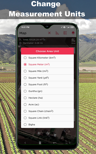
Select Measurement Units: Choose your preferred units for area and distance (e.g., square meters, acres, kilometers, miles) in the app settings.
Measure Area:
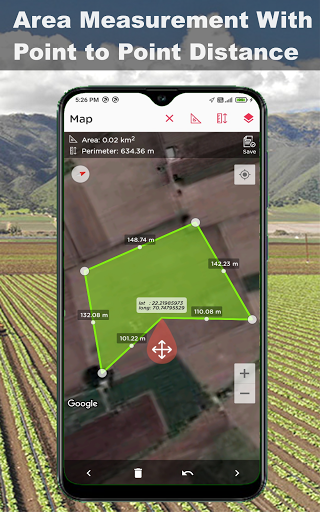
Manual Point Placement: On the map, drop pins to mark the corners of the area you want to measure. The app will automatically calculate the enclosed area as you place the points.
GPS-Based Measurement: If you’re physically at the location, you can use your GPS to walk the perimeter of the area. The app will track your movement and calculate the area based on the GPS coordinates.
Measure Distance:
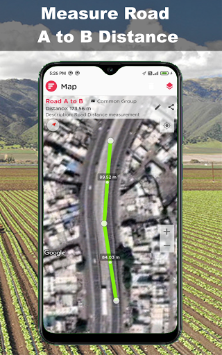
Line Measurement: To measure the distance between two or more points, place pins along a straight or curved path on the map. The app will display the total distance between the points.
Adjust and Save Measurements:
Edit Measurements: If needed, adjust the position of the pins on the map to refine your measurement.
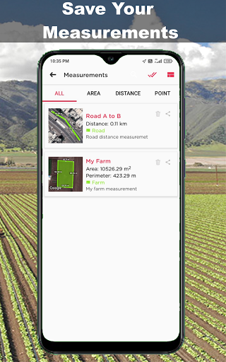
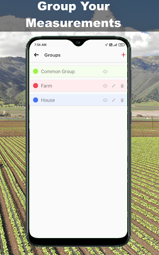
Save Projects: Save your measurements as individual projects within the app for future reference. You can label each project with a custom name for easy identification.
Export and Share Results:
Share Measurements: Export your measurement data in various formats, such as KML, KMZ, or CSV, and share it with others via email or cloud storage.
Print or Save as PDF: Generate a PDF report of your measurements with all relevant data, including maps, distances, and areas.
Track Historical Data:
The app allows you to store and access your historical measurement data, making it easy to compare changes or revisit previous projects.
Advanced Features (Optional):
Polygonal Measurement: For irregularly shaped areas, use the polygon tool to calculate areas more accurately by marking multiple boundary points.
Elevation and GPS Accuracy: The app may offer elevation data and accuracy metrics to help ensure your measurements are as precise as possible.
Offline Mode: Some versions of the app offer offline mode, allowing you to download maps and use the app without an internet connection.
Regular Updates:
Keep the app updated to access the latest features, improvements, and bug fixes.

